I recently received a very basic training in GIS and an open source software called QGIS (http://www.qgis.org/en/site/forusers/download.html). This software is very powerful and achieves very good if not better results than its licensed counterpart ArcGIS (https://www.arcgis.com/features/index.html).
The training lasted just for a few hours and it was very practical so I am by no means an expert but still as a result able to produce basic good looking maps with data.
QGIS has a very informative and well made manual which you can find in the ‘Help’ tab once you ave downloaded and installed the program.
If you are familiar with some kind of image editing software (GIMP, Photoshop etc.) form before that uses layers, then this will help you a lot in understanding how the QGIS interface works. Otherwise practicing and messing around with the software is the best way to get an understanding of how it works. There are also many YouTube tutorials and online communities where you can get more training and info.
A useful source to get basic geographical data like administrative boundaries, road&rail networks, water bodies, population distribution etc. is from this site: http://diva-gis.org/. To start with this is all you need to get a handle of how it all works. I also suggest you to download and install a plugin called “QuickMapServices” (available in the software, so you do not have to hunt for it yourself). This allows you to add a google maps layer to your maps as seen from my example below.
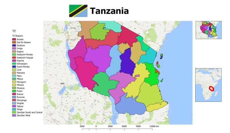
So below is just a very quick map i threw together in about 10 minutes during the training. Doesn’t look amazing but it shows you just what you can achieve in a very short time.